About woods
Geographical features of Republic of Macedonia
 Republic of Macedonia occupies rather small area. The longest airline distance north to south is about 150km, and east to west about 210 km. Despite this, great heterogeneity can be noticed in the soil cover.
In our country there are many geologic formations with different age, different geographic and granular composition. There is an influence of more climates (continental, Mediterranean, mountainous) whose elements vary to large extent and that leads to appearance of many different floral associations. Due to the long term influence of pedogenetic factors our soil in time was changing and attained different degree of evolution. The long term human influence had also its own contribution which had changed the direction of the natural pedogenetic processes of our soil.
Republic of Macedonia is continental country, occupying the central part of the Balkan Peninsula , between 40° 50’ and 42° 20’ average geographical width and between 20° 27’ 30" and 23° 05’ east geographical length .It borders Albania in the west (191 km, )Greece in the south (262 km) , Bulgaria in the east (165 km) and with Serbia in the north (231 km). The total border length is 849 km, with a total area of 25.713 km2.
Configuration
Republic of Macedonia has many complex geology and extensive configuration which causes large variations of soil types.
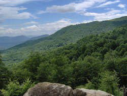
The mountains are big configured forms which cover around two thirds of the territory of the country. They are part of old clan group. They are part of the old Rodopian group, in the east part and the young Dinar group, in the west part of the country. The Rodopian group of mountains are lower than 200 meters, with the highest pick Ruen 2252 meters of the Osogovo mountains. Dinar mountains are higher and raise above 2500 meters, with the highest top in Macedonia Big Korab- 2764 meters. Among these two mountainous groups Vardar area is located, along the two sides of river Vardar and Pelagonia horst anticlinorium in the central part of the country.
 Valleys and large fields cut the mountainous configuration structures, covering around one third of the surface of the country. The most impressive are those valleys which extend along the river Vardar, including Skopje valley (1840 km2), while the biggest plane is Pelagonia plateau, in the southwest part of the country which comprises area of about 4000 km2, with an average altitude of 600 meters.
The karst configuration is specific for the Republic of Macedonia and is mostly spread in Paleozoic, Mesozoic, Paleocene, and Neocene lime stones which are found mostly in the central and west part of the country. The composition includes surface carst forms of crevices, depressions, hollows, and karst fields, as well as underground configuration forms, including 164 caves and 12 pits and abysses.
Hydrograph
Macedonia is considered as rich with water, with recorded and mapped 4,414 springs, whose total annual capacity reaches 6.63 billion m3 of water. In hydrologic sense the Republic of Macedonia is divided among the three water river basins of Adriatic sea (15% of the territory), with main mouth, river Crni Drim, Aegean Sea (85% of the territory), with rivers Vardar and Strumica, as the biggest water courses and Black Sea, whose river basin has insignificant territory.
 Vardar is the biggest river with around 80 % of the total water flowing out from Macedonia. Its total length is 388 km, 300 km of which flow in the Republic of 174 m2/sec.Larger right tributaries of river Vardar are river Crna (207km length) and river Treska (138 km, while the longest left tributaries are river Bregalnica (225 km) and river Pcinja (135km).
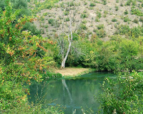
Being continental and having no access to sea, Macedonia is proud of the natural and artificial lakes. The most attractive of the natural lakes are tectonic lakes Ohrid, Prespa and Dojran. Lake Ohrid is the biggest, with surface of 358.8 mk2, of which 229.9 km2 belong to Macedonia, and the rest to Albania. The smallest, lake Dojran, contrary to the previous two which are located in the west part of the country, is located in the southeast part and has surface of 42.7 km2, and it belongs both to Macedonia and Greece.
Climate
If Republic of Macedonia and the neighboring regions were flat, they would have more expressed Mediterranean climate, if the geographic width and proximity of seas is taken into consideration. Secondary factors (complex configuration structure, side elevation) modify the Mediterranean influence.
Because of the specific natural and geographic properties, in Macedonia two main types of climate prevail: altered Mediterranean and moderate continental. Hence, two annual seasons may be distinguished: cold, wet winters and dry, hot summers, connected with transient seasons, spring and autumn. Spring begins early, and autumn late. Autumn (especially October) is hotter than spring (April). Additionally, mountain climate prevails on high mountain regions which characterizes by short and cold summers and mainly cold and moderate, humid and snowy winters.
The average annual temperature is high (above 14 - 15 ° C), average annual fluctuation is small (above 20° C). The absolute temperature fluctuation is smaller (usually above below 50 ° C). In mountain climate regions, average annual temperatures are: 4,7 ° C on Popova Shapka (1750 m), 6,8 ° C in Lazaropole (1330 m), and 8,2 ° C in Krushevo (1230 m).
The moderate-continental climate (east-European variant) is distinguished by cold winters with large number of frosty days, with average month temperature in the coldest month below zero, with low average minimum temperatures and low absolute minimums and with decreased rainfalls. Summers and vegetation period in comparison to Mediterranean climate, are shorter, with low humidity and with less sunny and tropic days. The transition from summer to winter and from winter to summer is relatively quick. The average annual temperature is lower than in Mediterranean climate, but the average annual and absolute annual fluctuation is significantly high. The quantity of rains and the relative annual fluctuation of rains is smaller. Rains prevail mostly in the hotter part of the year (the fifth and the sixth). They frequently have stormy form.
The mountainous climate prevails in particularly extreme form in the highest (the Alps) mountainous region, and to some extent milder form in the sub alps region. This climate is distinguished by low average annual temperatures (around 0 ° C), with particularly cold winters (the coldest month averagely below- 5 ° C). The average month temperatures are below 0 during 5-6 months and number of frosty days is quite great (3-4 months). This climate is distinguished by not so low absolute temperatures average (up to - 24 ° C), with low average (below 20°C) and absolute amplitudes (below 60 ° C), with short and cold summers (average temperatures below 10 ° C without drought periods) and with expressively hotter autumn than winter. The amount of rainfall is increased and pluviometer regime gets its continental character.
 The high mountains (Baba, Nidze, Kozjak, Kozuv, mountain Neretska, mountain Belasica) are the obstacle for the Mediterranean climate to break through, from south, from the Thesaloniki bay. It gets through to north along river Vardar valleys, along rivers valleys Strum and Strumeshnica (from Orkan bay), in light form through Kizli-Derven gorge, along south tributary of Dojran. It is highly expressed up to Demir Kapija (regions of Gevgelija, Valandovo, southwest part of Strumica region). In lighter form (modified) under the continental climate influence it gets through theVardar valley up to Skopje valley, along the valley of Crna reka (through Tikvesh region).
Biological diversity
The Republic of Macedonia had ratified the Convention of biological diversity in1997 and became party in the convention on March.2.1998.
The estimation of the biological diversity and status was made in order to discover the general aspects of protection, along with other global threats, as the climate changes and soil degradation. The most important properties of the biological diversity in the Republic of Macedonia are the large heterogeneousness and high degree of relics and endemism.
Flora
The vegetation in the Republic of Macedonia is a mosaic of various communities with representatives of various vegetation types. In terms of the lower flora groups in the country, algae are especially diversive group of organisms, of which about 1580 species have been defined so far. Mushrooms are heterogeneous group of organisms, and with the previous explorations 1250 species were registered, while the lichens number is around 340 species.
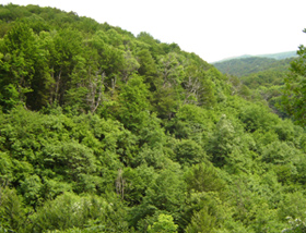
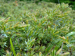
 Flora at higher floragroups is pretty rich, with mosaic of various flora vegetation elements (tertiary relics, Mediterranean ,Greek- Anatolia, Alaric Kafkas ,Medium European, Euro Asian, Arkto Alps and cosmopolite) and great number of endemic types (Macedonia, south Balkan and Balkan). Flora is presented with 210 families, 920 clans and around 3700 species. The most numerous group are flower hidden seed plants, with around 3.200 species, mosses (350), ferns (42) and large seed flora (15).
Among lower flora groups, algae are represented with the greatest number of endemism, with 135 endemic tax sons or 8.5 % of the total flora of algae. Most of them are found in Ohrid and Prespa lake, a small number in Dojran lake, at mountain Pelister and in river Babuna. In higher flora groups many endemic species (totally 117 species), are also found and are mainly seen among seed plants (114).